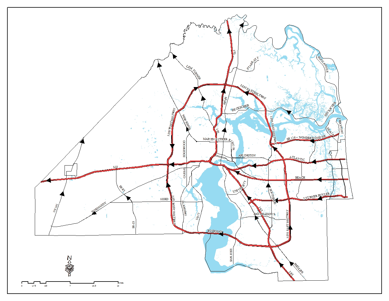
Evacuation Routes For Duval County
Evacuations are a serious matter. Duval County has three major routes to travel west from the Beaches community, and two interstates to travel north or west to a safer location.
Non-residents and Visitors
Traffic will be routed from the southern point of entry into Duval County on I-95 North, onto I-295 North, and back onto I-95 North to exit the county.
Residents
Traffic will be routed westward from the Beaches community on either J. Turner Butler Boulevard, Beach Boulevard, or Atlantic Boulevard. Traffic will then be routed westward through the downtown area to I-10 West until evacuees have entered a public shelter, reached a safe area in the county, or departed the county. Other areas within the pre-designated evacuation zones, generally travel through the downtown area onto I-10 West until evacuees move into a shelter or depart Duval County.
Remember, plan ahead and be prepared to evacuate based on instructions from city officials. If an evacuation is ordered, have enough gasoline, and other essential items, such as maps, medicines, contact information, food, water, and items for your pets. Once you have made the decision to evacuate, leave early.
If you need help evacuating, plan ahead and register with the city. For more information on evacuation routes and zones, or assistance with special needs registration, please call Duval County Emergency Management at (904) 255-3110.